Home > Products

PRODUCT

Products

Public security video integrated application platform
HW-S82Y-J

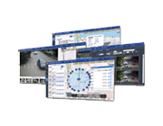
The police video integrated application platform is based on the video surveillance network sharing platform and the video image information database system. It is a video image information depth application platform for police practical application.

By integrating all kinds of video surveillance resources, taking PGIS as the foundation, time-line orbit as the benchmark, using dynamic video and static 3D display, the platform constructs a space-time model which integrates video dynamic reconnaissance, real-time control attack and video patrol prevention. The system is seamlessly connected with police syntheses, motor vehicles, receiving and alarming systems, card data, PGIS and so on. The video surveillance cameras are logically linked and the video images are intelligently organized to realize automatic extraction and collision comparison. The video clues and evidence sharing and pushing mechanism are established to realize the integration of video combat applications.


System characteristics

1, the Ministry of public security science and technology innovation project research results

2, the key technology research achievements of the Ministry of public security video and image database.

3, create a dynamic video three-dimensional prevention and control model based on "circle block grid point".

4, a path tracking model based on timeline PGIS.

5, video surveillance camera logic linkage and image intelligent organization.

6, video and image "space time shuttle" technology

7, video surveillance scene 3D display technology

8, deep integration of video intelligent analysis tools.

9, the integrated application of video and bayonet.

10, the whole process of investigation operations.

11, the comprehensive application of public security basic information.

12, based on "index + data block" video exclusive cloud storage.


major function

1. The monitoring systems are interoperable with each other through GB / T28181, DB33, ONVIF and so on. Other heterogeneous systems use gateways for conversion access. After the convergence, the platform manages and dispatches the monitoring points uniformly. The basic functions of real-time video preview, video retrieval, playback and download are realized.

2. Based on the series standards of "Public Security Video Image Information Application System" issued by the Ministry of Public Security, and on the basis of large data and stream calculation, through cleaning, organizing and sorting out the structured description information of video image information, the efficient storage and analysis of massive video image information data are realized, and the feature recognition and intelligent analysis are provided. Intelligent search, sharing and other supporting services.

3. Through the data exchange with the card port/electric police equipment or the corresponding platform, the functions of inquiry, analysis and statistics of mass passing information are realized. It realizes vehicle query, vehicle trajectory analysis, vehicle prevention and control circle (circle grid point), vehicle detection and control, illegal information collection, illegal information confirmation, retrieval, traffic statistics and so on.

4. On the basis of PGIS, the platform integrates video surveillance, security card port, electronic police and other video image information on the map, and integrates social video, communication base station, Hotel Internet cafe and other related resources. Organizing all kinds of resources with the concept of circle grid line point defense and control circle, taking image as the center, taking people, vehicles, objects and cases as the elements, combining with the actual combat idea of graph-based operation, creating a multi-police integrated and sharing platform.

5. Path analysis technology is firstly created on PGIS map. According to the moving direction and speed of the target, the intelligent route trajectory is designed for real-time, three-dimensional patrol and tracking, and the three-dimensional video image information based on the logical relationship between cameras and the spatial morphology of the region is formed. Video, image, other sensing devices and other resources are dynamically organized on each possible path to track and control suspects accurately and coordinate police force blocking and intercepting, which greatly improves the precision of video surveillance in the defense, security, anti-terrorism, emergency prevention and control capabilities and actual combat efficiency.

6. Based on the latest achievements of intelligent video analysis, the platform digs and analyzes a large amount of video data in depth, making it structured, informationized and intelligent. At the same time, it integrates case clues and case management information organically, including video concentrate summary, video retrieval, video analysis, vehicle feature recognition, and graphics. Functions such as searching, assisting investigators to quickly extract effective information from massive video image information, locking the suspect target, speeding up the case video clue detection speed, and improving the efficiency of investigators.

7. The platform upholds the concept of serving criminal investigation and actual combat, linking all kinds of resources in the process of case study and adjudication to provide more clues. The system integrates all kinds of related public security resources and integrates closely with PGIS police geographic information system, three-in-one command and dispatch system, traffic police off-site law enforcement system and synthetic combat system to realize the information base of motor vehicles, motor vehicle theft and robbery depot, vehicle traffic violation record base, receiving and handling police system, police comprehensive platform and intelligence level. The integrated access of Taiwan, permanent population pool, temporary population pool, key personnel pool and criminal investigation pool provides data support for case analysis.